Range 9 Land Surveying
About Your Boundary Survey
If you're not familiar with a survey, you may think that it's merely measuring your property and placing a few flags in at the corners. But there's much more to it!
When a survey order is received, the office staff begins researching the property, starting with the actual legal description. The legal description describes your actual property. It can come from a deed or title insurance, which is typically provided by the property owner or a legal representative. In some cases, the survey department researcher might obtain these documents from the county recorder's office. The legal description is then checked against any other available documents to see if there are any differences.
Once the legal description of the property is accurately determined, the surveyor has to decide how that property fits in relation to the properties around it. If the property is a "platted" lot, such as in a subdivision or town, they will look at the original subdivision plat, a drawing which shows how the area was originally divided. These are usually found at the county recorder's office. While newer subdivision plats are fairly easy to obtain, some -- such as town plats going back to the early 1800s -- can be hidden away in crumbling archival books tucked away in back rooms. Sometimes a lengthy page-by-page search is required to find the correct document.
If the property is not platted, such as a farm or rural home, a "section breakdown" must be done. A section consists of 1 square mile, or 640 acres. A section breakdown involves finding the relevant corners of the section, then measuring in from them to determine the quarter section, followed by further divisions of the section until the boundary of the property can be accurately determined. This is a lengthy process that, in some cases, can take a field crew more than a day.
On the ground, the field crew determines the property's boundaries by using precision equipment to measure from existing "monuments", which are permanent markers left in place by previous surveys. Monuments can be proprietary iron rods placed in the ground, a cross cut into a sidewalk, a stone in a specific location, or even a mark made in a tree. These monuments are typically recorded on the original plats, or mentioned in the property's legal description. Modern surveyors use iron rods or pipes as monuments when possible, as it is easy to locate them with metal detecting devices. The surveyor records each monument he finds, then measures them against the other information he or she has.
If everything goes well, the property will measure as it's recorded. Often the property doesn't exactly fit its description, and the surveyor has to determine why, and how to correct the problem. This may require measuring again using different monuments, adjusting for possible measurement errors on the original plats, calculating for possible adjustments, or other means. The surveyor should always attempt to determine the original surveyor's intent, going back as early as possible.
Once the correct boundaries are determined, above-ground flags will be placed to show the property owner the approximate location of underground boundary markers. If any are missing, the surveyor replaces them precisely in the correct location. If there are buildings or other permanent improvements on the property, those are also accurately measured and recorded.
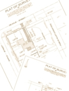
If a survey plat (drawing) has been ordered with the survey, this information is then taken back to the office, where it is imported into a CAD drafting program and carefully and accurately rendered in detail. A drawing is created from the information, showing the boundaries, improvements, all relevant monuments, legal description of the property, and other details. When completed, the drawing (or survey plat) is then printed on a large scale plotter. The surveyor examines the final plat for errors, and, if it's correct, will sign and legally certify the plats. The certified copies are then provided to the client or their legal representative. If the survey is for a real estate closing or other legal transaction of the property, non-certified electronic copies may be sent to attorneys, real estate agents, and other interested parties.